Urban Climate
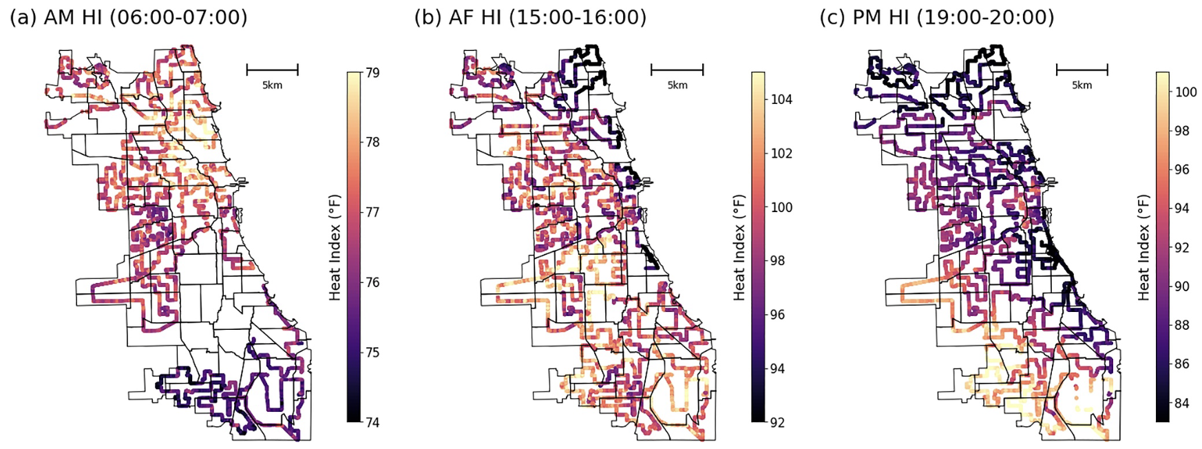
My urban climate work tracks how city form, land cover, and daily activity amplify or dampen heat exposure. Using dense sensor networks, crowdsourced transects, and remote sensing, I map neighborhood-scale heat index and boundary-layer structure to reveal when and where residents face the highest risk. These measurements feed process-based models and help target mitigation strategies like cool corridors, reflective infrastructure, and tree canopy investments.
A key emphasis is co-developing digital twins that blend observations with high-resolution simulations. By partnering with local agencies and community groups, the models stay grounded in on-the-ground priorities—from emergency response to long-term planning—so that the science directly supports equitable resilience policies.